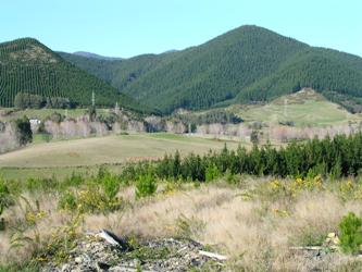
Tall vegetation effects on water yield
Research Status: Ongoing |
A mixed land use catchment with tall vegetation in the headwaters |
Introduction
A decision support system (DSS) has been developed to assist land managers in assessing possible changes in water yield from a catchment with a change in vegetation cover. The DSS consists of compiled background information on water use by different vegetation covers in New Zealand, and a simple-to-use computer model (WATYIELD) that simulates water yield changes following a change in vegetation cover. The project has been supported by the Sustainable Management Fund (SMF) from the Ministry for the Environment and also 6 regional and city councils in New Zealand.
Research Approach
Five reports have been compiled that details aspects of water quantity and land use change. The reports are a synthesis of knowledge up until 2004.
A simple-to-use computer model (WATYIELD) has been developed to simulate the effects of land cover change on water yields in small to moderate catchments.
WATYIELD is available for a free download. There is also a user manual available for download. Note: the model was updated in 2009 and the new downloadable zip file is available. (see More details below to access the reports and model).
Research Results
The 7 publications produced from the project are listed below (search main database by date to download reports):
- Report 1: Bibliography of world literature on water use by Pinus radiata (July 2001)
- Report 2: Bibliography of world literature on water use by Douglas fir (July 2001)
- Report 3: Bibliography of NZ literature on water use by other land uses such as tussock grassland, pasture and scrubland species (Nov 2001)
- Report 4: Summary of catchments with data available for use in evaluation of land cover effects on water availability (May 2003)
- Report 5: Hydrological effects of different vegetation covers - Synthesis of data from catchments with available data (Nov 2002) N.B. There are appendices in a separate file
- Report 6: A comparison of streamflow from NZ catchments with differnt vegetation covers (July 2003) N.B. There are summary tables in a separate file
- Report 7: Users guide for the Decision Support Tool (January 2004)
Further research has been in the area of how forestry affects low flows and general flows. This has concentrated on taking available data and applying it through the WATYIELD model to investigate land use change implications
Recent Publications
Recent Presentations
BMPs, BEPs and Guidelines
| Title | Description |
| New Zealand Environmental Code of Practice for Plantation Forestry | The E CoP is an essential tool for anyone involved in forest management. Developed by the NZFOA, and...More » |
Primary Contacts:

|
Tim Davie
Email Phone: 03 372 7084 Fax: +64 (0)3 365 3194 More details» |
Institute Environment Canterbury |
Expertise Hydrology & modelling, surface water resource management |