Mechanisms of groundwater recharge
Research Status: Ongoing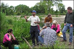 |
Joseph Thomas (TDC) talking at 2005 AGM |
Introduction
The upper reaches of the Waiwhero Stream and Orinoco River have been identified as the area where rainfall infiltration recharges groundwater into 3 deep aquifers contained within the Moutere Gravels underlying the Moutere valley. Water from these aquifers provides the major source of irrigation water for land users in the Moutere valley. Continued availability of groundwater for irrigation users in the Moutere valley is dependent on annual recharge of these aquifers.
It has been inferred that the location of the recharge zone is controlled by the outcropping of a more permeable unit within the Moutere Gravels at the surface in the recharge zone. However, it is not clear whether recharge occurs uniformly across the recharge zone or whether there are preferred pathways for infiltration recharge. The recharge zone mainly comprises hilly terrain underlain by soils and regolith that has very slow permeability, and there may be a slow rate of recharge through these soils. Alternatively losses of water from streamflow in the valley bottoms, or from soils in lower slopes, may be a preferred pathway since these areas tend to be underlain by more permeable soils than the hilly terrain, and by more freely draining gravels.
With this precipitation-infiltration recharge model there is believed to be a connection between land cover and recharge rates. For rainfall to percolate into the aquifers, any soil moisture deficit needs to be overcome. Then surplus water is available to runoff or recharge groundwater. Changes from short to tall vegetation reduce the total surface water yield and this same effect is likely to apply to the amount of water available for groundwater recharge. Hence, TDC has proposed land use controls within the recharge area to limit afforestation and protect recharge of the Moutere aquifers.
The mechanism of groundwater recharge of the Moutere aquifers may also be relevant to aquifers underlying high terraces in the upper Motueka valley.
Research Approach
The objective of this research is to establish the mechanisms and rate of groundwater recharge of the Moutere aquifers from land within the Motueka catchment. Specifically:
- Compare the hydraulic response of the Moutere aquifers to rainfall, modelled patterns of soil drainage, and irrigation abstractions
- Determine rates and amounts of soil drainage from the full range of landforms in the recharge area, including the role of streamflow losses
- Determine the sources of water in the Moutere aquifers using chemical and isotopic tracing techniques
- Evaluate the influence of tall vegetation cover on rates of groundwater recharge
Research Results
Results include: .....
 |
 |
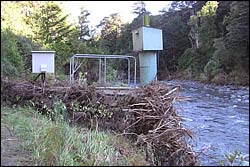
Flood debris at Motueka Gorge gauging station |
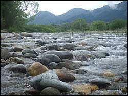
Wangapeka River |
Recent Publications
Recent Presentations
| Year | Title | File Size |
| 2006 | Integrating groundwater modelling and river ecology. |
|
| 2006 | Integrating groundwater modelling and river ecology for improved understanding. |
|
BMPs, BEPs and Guidelines
| Title | Description |
| Southland’s Wetlands assessment Guide | A tool kit for use by landowners that includes practical advice and assistance to encourage the main...More » |
| A National Protocol for State of the Environment Groundwater Sampling in New Zealand |
From website: This document provides a step–by–step protocol for the collection of...More » |
| Permeability Guideline | A quick reference to district plan rules on permeability in response to complaints about increased s...More » |
Primary Contacts:

|
Tim Davie
Email Phone: 03 372 7084 Fax: +64 (0)3 365 3194 More details» |
Institute Environment Canterbury |
Expertise Hydrology & modelling, surface water resource management |

|
Timothy Hong
Email |
Institute GNS Science |
Expertise Groundwater modelling |

|
Mike Stewart
Email Phone: 04 570 4803 Fax: 04 570 4603 |
Institute GNS |
Expertise Groundwater studies, isotope tracing |

|
Joseph Thomas
Email Phone: 03-544 3394 Fax: 03-543 9524 |
Institute Tasman DC |
Expertise Water Resources |