Historical development
Research Status: Past |
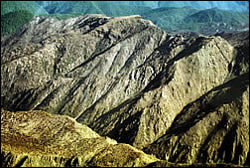
Red Hills |
Introduction
History of settlement in the Motueka River basin
Archaeological evidence suggests that Maori groups first settled the Motueka River area before 1350 A.D. and more permanent camps and fortifications (pa) were gradually established.
Settlement was largely restricted to the coastal areas, although Maori travelled through the catchment in search of valued "pounamu" or greenstone (argillite). Inter-tribal conflicts decimated the local tribes (iwi) in 1828-1830, about 10 years before the first European settlers arrived.
Early European settlers were largely interested in sheep grazing land and in gold. Gold operations existed in the area until the early 1900’s.
A major flood in February 1877 transformed the shape of the catchment, as a consequence of widespread mass wasting. This event has left a legacy that is important even today.
Subsequent flooding prompted local river boards to construct stop banks in the lower river in the 1950’s.
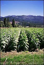
Introduction of tobacco in the 1920’s brought a period of growth and prosperity. Decline in the tobacco industry in the 1950’s was followed by a rise in fruit tree, berry fruit, and hops and by a rise in commercial forestry.
Plantation forests - stocked primarily with exotic species such as Monterey pine (Pinus radiata) and Douglas fir (Pseudotusga menziesii) were established on less-fertile, steeplands abandoned and purchased from farmers.
More recently, vineyards, marine farming, and tourism have added substantially to the diversity and productivity of the local economy.
Social & cultural setting
New Zealand is a bi-cultural nation, recognising the contributions of both Maori and Europeans (pakeha). The legal document defining the relationship between Maori and pakeha is the Treaty of Waitangi (1840).
After languishing for over 100 years, the treaty has served as the basis for recent claims by Maori groups over various land and water resources. These claims are often a source of strong debate, tension, requiring negotiation and resolution.
A number of Maori tribes (iwi/hapu) are active the Motueka River area and their view and interests are an important part of the integrated catchment management programme.
One of these iwi are based at Te Awhina marae in Motueka township.
Research Approach
Literature search and dialogue to uncover both written and oral histories of the settlement of the catchment and the uses to which the land was put for productive purposes.
Research Results
- Mäori migration and occupation into the northern South Island and Motueka catchment
- Tangata Whenua
- Mäori values and history
- Mäori present day
- Population details of Tasman
 |
 |
Tobacco fields |
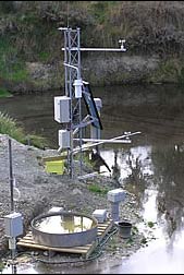
Environmental monitoring |
Recent Publications
| Year | Title | File Size |
| 2012 | A Summary of Outcomes and selected formal publications from the Integrated Catchment Management (ICM)research programme:2000 – 2011 |
|
BMPs, BEPs and Guidelines
| Title | Description |
| Tourism Planning Toolkit For Local Government |
From website: The Tourism Planning Toolkit is a set of tools to help local authorities plan fo...More » |
| Heritage Management Guidelines for Resource Management Practitioners |
From Guide: Guidelines on sustainable management of historic heritage to promote understanding...More » |
| Managing Your Bush Block:A guide to looking after indigenous forest remnants in the Wellington region | Tips and techniques of managing bush blocks....More » |
| Protecting and Restoring our Natural Heritage – a Practical Guide |
From website: This guidebook provides information on protection, management and restoration of...More » |
| Contaminated Land Management Guidelines No. 1: Reporting on Contaminated Sites in New Zealand |
This is the first of a series of documents on contaminated land management, published by the Ministr...More » |
| Risk Screening System Contaminated Land Management: Guidelines No. 3 |
This guideline describes the background to and use of the Risk Screening System (RSS). The sys...More » |
| Contaminated Land Management Guidelines No. 2: Hierarchy and Application in New Zealand of Environmental Guideline Values |
From Executive Summary: This guideline document is the second in a series of documents on cont...More » |
Primary Contacts:

|
Will Allen
Email Phone: 03 321 9600 More details» |
Institute Landcare Research |
Expertise participation, multi–stakeholder processes, participatory evaluation, networking |

|
Andrew Fenemor
Email Phone: 03 545 7710 More details» |
Institute Landcare Research |
Expertise ICM programme management; local liaison; resource management; hydrology and water resource management |

|
Garth Harmsworth
Email More details» |
Institute Landcare Research |
Expertise environmental planning, Maori research, Maori issues, land resource assessment, GIS applications. |
Page last updated Tuesday, 4 September 2007