Upper Motueka water resources
Research Status: Ongoing |
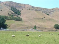
Irrigator in Tapawera region during summer |
Introduction
Sustainable allocation and management of groundwater and surface water resources in the Upper Motueka Catchment is a key issue.
The Upper Motueka area (The Motueka Catchment from the Wangapeka confluence upwards) has a sizeable area of fertile alluvial river terrace land that is suitable for irrigated agriculture. There is concern that extraction of shallow groundwater for irrigation may lower groundwater levels and consequently the baseflow of rivers/streams during the summer season due to strong shallow aquifer-surface water interactions in this area. This would reduce the availability of surface water to existing users and add pressure in terms of water allocation to keep minimum baseflow requirements for the Motueka River in compliance with the requirements of the Motueka River Conservation Order.
To assist in the sustainable management of water in the Upper Motueka region this research aims to develop an understanding of:
- The interactions between groundwater and the river(s) in the Upper Motueka valley (above Tapawera)
- The effect of possible irrigation scheduling on river flows in the Upper Motueka valley
- The impact of land use change on groundwater recharge
Research Approach
There are four strands of work currently being carried out within this research area. The research also links in strongly to trout habitat work being undertaken by Roger Young and Dean Olsen at Cawthron.
- Developing a 3 dimensional model (using FEFLOW) of the surface and groundwater for the Upper Motueka Region. The model is being developed in a joint study, conducted with the Institute of Geological and Nuclear Sciences (GNS), Landcare Research and Tasman District Council (TDC).
- Developing models of water abstraction, irrigation scheduling and surface water balance to provide input into the 3d model above.
- Carrying out a field investigations to provide input data for the models. This includes: investigating the role of hillslope flows to overall recharge in the valley system; geological and groundwater resource studies; and continuous measurements of water level at points in the river through summer.
- Isotopic and geochemical analysis of surface and groundwater to determine ages and water mixing ratios.
Research Results
Modelling
The FEFLOW model has been calibrated for steady state conditions (i.e. yearly average figures) and is currently being calibrated/validated for transient state (i.e. daily timestep).
Isotopic work shows that there is a mixing of surface and groundwater throughout the region. At the top (Motueka Gorge site) the mean residence time (MRT) of river water is approximately 1 month. Lowere down the MRT of river water is 2-4 months while a spring fed stream (at Hinetai) has a MRT of 14 months.
Results from the study are in the presentations and publications listed below.
 |
 |
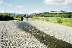
Low flow in the Motueka River in summer |
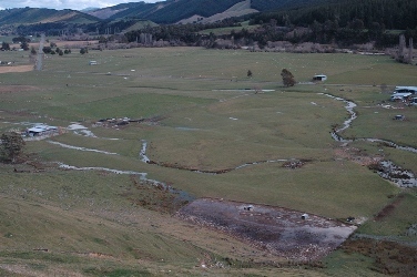
Surface water pathways on normally dry Motupiko Valley bottom |
Recent Publications
Recent Presentations
Primary Contacts:

|
Tim Davie
Email Phone: 03 372 7084 Fax: +64 (0)3 365 3194 More details» |
Institute Environment Canterbury |
Expertise Hydrology & modelling, surface water resource management |

|
Timothy Hong
Email |
Institute GNS Science |
Expertise Groundwater modelling |

|
Mike Stewart
Email Phone: 04 570 4803 Fax: 04 570 4603 |
Institute GNS |
Expertise Groundwater studies, isotope tracing |

|
Joseph Thomas
Email Phone: 03-544 3394 Fax: 03-543 9524 |
Institute Tasman DC |
Expertise Water Resources |