Tasman Bay productivity
Research Status: Ongoing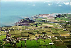 |
Motueka delta |
Introduction
Fish and shellfish resources in Tasman Bay are highly variable in terms of their distributions, growth rates and reproductive success. To manage them sustainably, requires an understanding of factors that control that variability and how the ecosystem in general functions.
Research Approach
A specific goal of this work is to determine how the quantity and quality of freshwaters from the lower Motueka River affect the productivity of Tasman Bay. Research has been focused on surveying the coastal habitats, collecting hydrodynamic and nutrient data in Tasman Bay, and developing an understanding of the importance of the freshwater input of the Motueka River to Tasman Bay's productivity.
Research Results
Microscopic plants that live in seawater (phytoplankton) and on the seabed (benthic microalgae) are the primary building blocks that nourish the coastal food web of Tasman Bay. This objective builds on about 20 years of Cawthron research into the taxonomy, and ecology of these plants in coastal waters of New Zealand. Both the planktonic (suspended in the water column) and the benthic (bottom-living) communities are complex with many different species that wax and wane (as do many land plants) throughout the year. Much of this work was of a fundamental nature required to build a basic understanding of these communities, including the species involved and key factors and processes that control their growth and distribution. Now that we have this platform of knowledge, we are in a better position to address specific questions that relate more closely to sustainable management of coastal resources.
We know that the availability of inorganic nutrients such as nitrogen, phosphorus and silicon are important to maintain coastal productivity. The availability of light for photosynthesis is also important. The Motueka River delivers nutrients from the catchment to fertilise the coastal environment. Too much or too little nutrient can negatively impact on fish and shellfish resources. The distribution of nutrients can also be affected by the degree of stratification in the water column. As the River waters flow into the Bay, they spread out in a surface layer of low salinity water over the more dense seawater below. This density stratification stabilises the water column and reduces vertical mixing processes that keep the nutrients well distributed for phytoplankton nourishment. The River also delivers sediments that effect light penetration and consequently can hinder photosynthetic activity. Sediments can also affect seabed animal communities in a variety of ways. They nourish a dynamic delta region of sand spit development that provides habitat for a variety of shellfish. Investigations of relationships between river flow characteristics and habitat development/stability are planned for this year. Past work has led to the discovery of a near-bottom high turbidity layer, within the Motueka plume, that could have profound ecological implications.
The Motueka River provides about 62% of the total freshwater inflows to Tasman Bay. Preliminary calculations allow us to compare mass transport characteristics of the Motueka River with those of other tributaries and wastewater discharges to the Bay. However these are only "ball park" estimates at this stage and they require improvement/validation through continued monitoring (particularly during storm-affected periods).
In order to determine how important the quantity and quality of the Motueka River is in controlling productivity, we are trying to link its discharge volume and composition with seawater characteristics that affect plant growth. With regard to receiving waters, we have established a network of >80 water column and seabed sampling sites that provide a blanket-coverage of the region affected by the Motueka plume (essentially the entire western side of the Bay extending to some 18 km off shore). Thus far we have sampled these sites on two occasions. The first, 7-8 March of this year, was after an extended period of low river flow. The second, two months later, was after the first significant flush. Comparison of physical, chemical and biological characteristics at the sites under these two extreme river flow conditions gives us a preliminary look at the areal extent, and the degree, to which the river exerts a significant influence.
Surface salinities, water column stratification characteristics and nutrient concentrations were affected to various distances seaward from the Motueka River mouth. The region affected by reduced surface water salinities extended to more than 18 km off shore and encompassed most of the three zones identified by the Environment Court as aquaculture management areas. Turbidity profiles indicate that the previously observed near bottom high turbidity layer can be a widespread phenomenon within the Bay.
Implications: The results thus far indicate that the quantity and quality of the Motueka River can influence coastal productivity over a relatively large proportion of Tasman Bay. The data provides two point-in-time snapshots of the productive potential of the Bay. Although these snapshots in themselves do not provide enough information to base management decisions on, we are confident that as patterns emerge and relationships are identified, that the links with resource management will become clearer.
We now have a unique opportunity to relate detailed environmental data with industry data describing the regional and temporal variability of individual resources. The information will provide input for validation of a coupled hydrodynamic and ecosystem model that has been developed for the Nelson Bays. The model will facilitate transformation of scientific data into practical applications. Ultimately it will allow prediction of how various resources will respond to particular environmental events. For example, links between water column characteristics influenced by the Motueka plume during flood events, and shellfish spat settlement and survival, could provide the scallop enhancement and mussel industries with a means of optimising spat collection efforts. The model could also provide insights to the implications of spat collecting activities, and any future development of marine farming activities, on coastal productivity and general ecosystem functioning.
 |
 |
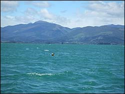
AGM 2006 - Cawthron monitoring buoy |
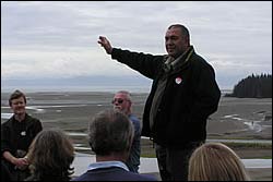
Barney Thomas discussing coastal issues at Puketawai |
Recent Publications
Recent Presentations
BMPs, BEPs and Guidelines
Primary Contacts:

|
Chris Cornelisen
Email More details» |
Institute Cawthron Institute |
Expertise Marine ecologist |

|
Paul Gillespie
Email Phone: 03 548 2319 Fax: 03 546 9464 |
Institute Cawthron Institute |
Expertise Estuarine & marine microbial ecology |

|
Weimin Jiang
Email More details» |
Institute Cawthron Institute |
Expertise marine and systems modeller |