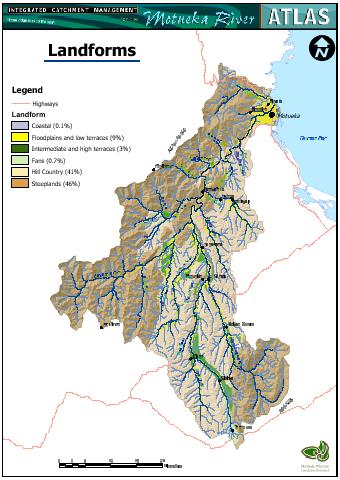
About 67% of the catchment has slopes greater than 15º.
There
are limited areas of gently sloping floodplain, terraces, and fans.
The
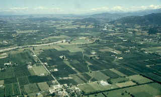
Motueka-Riwaka Plain
The
two most extensive flat areas are the 40 km2 Motueka-Riwaka
Plain near the coast and the 33 km2 upper Motueka.
|